
By Chevanev Charles, Esq.
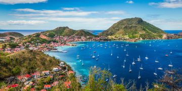
Imagine you are anchored 100 nautical miles off the coast of a Caribbean island. No storms on the horizon, the sun is almost in twilight, and your fishing line makes a clear sound as it disappears in the blue water. Beneath your boat lies an unseen and surprisingly complex frontier. There are no fences, no buoys, no signs — but there are invisible legal boundaries that determine who owns the fish below you, the minerals beneath the seabed, and perhaps even billions of dollars’ worth of oil and natural gas.
What if those unseen waters hold the Caribbean’s next great economic opportunity?
The Caribbean may be entering a new era of maritime diplomacy. In October 2025, Grenada proposed to establish a trilateral commission with St. Vincent and the Grenadines (SVG) and Venezuela to delimit their shared maritime boundaries. This signals an opportunity to bring certainty to one of the region’s last undefined maritime frontiers and potentially unlock significant economic opportunities.
The proposal follows Grenada’s successful maritime delimitation with Trinidad and Tobago between 2010 and 2012. Prime Minister Dickon Mitchell invited both then President Nicolás Maduro and then Prime Minister Dr. Ralph Gonsalves to formalize the process. With new leadership now in both SVG with Prime Minister Hon. Dr. Godwin Friday and Venezuela’s acting President Delcy Rodríguez, the proposal deserves renewed attention.
For SVG, a successful delimitation process would provide an opportunity to establish an offshore licensing grid, acquire modern geophysical data, and, where commercially justified, invite competitive bids for petroleum exploration licenses. Such a framework could attract investment in the millions, strengthen marine resource governance, and position the country to benefit should commercially viable hydrocarbon resources be discovered.
The proposed commission would consist of three representatives from each country and an independent chair from a neutral state, providing a structured and impartial forum for negotiations. Under the United Nations Convention on the Law of the Sea (UNCLOS), coastal states are entitled to maritime zones extending up to 200 nautical miles, including an Exclusive Economic Zone (EEZ), where they enjoy sovereign rights to explore and exploit marine resources such as fisheries, minerals, oil and natural gas.
Although SVG declared its archipelagic status under the Maritime Areas Act and has concluded maritime boundary agreements with Barbados (2015) and St. Lucia (2017), important boundaries with Grenada, Venezuela and Trinidad and Tobago remain unresolved.
This uncertainty limits SVG’s ability to confidently offer offshore exploration blocks, attract long-term investment, and fully develop marine industries.
Section 17 of the Maritime Areas Act provides that, until a formal delimitation agreement is reached, SVG’s offshore areas extend to the equidistance line between its archipelagic baselines and those of neighbouring states. While this provides a temporary legal framework, differing interpretations of the equidistance principle can become contentious where valuable marine resources are involved.
Traditionally, Caribbean maritime boundaries have been negotiated bilaterally. A trilateral approach offers several advantages:
- Efficiency: A single process can resolve multiple overlapping claims while reducing duplication.
- Transparency: An independent chair enhances confidence in the negotiations.
- Regional Cooperation: It demonstrates that Caribbean states can peacefully resolve maritime issues under the UNCLOS Treaty.
The importance of clearly defined maritime boundaries is illustrated by the dispute between Ghana and Côte d’Ivoire. Their disagreement over offshore oil and gas resources ultimately required adjudication before the International Tribunal for the Law of the Sea, which established an equitable maritime boundary in 2017. While the circumstances differ, the case demonstrates how unresolved maritime boundaries can delay investment and increase regional tensions.
To capitalize on Grenada’s initiative, SVG should:
- Appoint a multidisciplinary maritime delegation with expertise in international law, marine science and diplomacy.
- Update hydrographic and legal studies to accurately assess baseline coordinates, overlapping claims and resource potential.
- Coordinate national stakeholders, including the Ministries responsible for Foreign Affairs, Legal Affairs, Fisheries and Maritime Administration/Affairs.
- Seek technical support from Commonwealth Secretariat, Oceans and Natural Resources (ONR), UN Division for Ocean Affairs and the Law of the Sea (DOALOS), UK Hydrographic office, CARICOM and the OECS, all of which possess valuable experience in maritime boundary negotiations.
- Review the Maritime Areas Act to ensure it reflects current international maritime law and accommodates modern approaches to offshore resource management.
Maritime boundaries are more than lines on a map. They define the extent of a nation’s sovereign rights, provide certainty for investors, strengthen environmental stewardship, and reduce the risk of future disputes.
Grenada’s invitation presents SVG with an opportunity to resolve longstanding maritime questions through cooperation rather than legal conflict. It is an opportunity that deserves careful consideration not simply because of what may lie beneath the seabed, but because legal certainty at sea strengthens national sovereignty and creates the foundation for future economic development.
Chevanev Charles, Esq. is a UK-trained Vincentian lawyer with a master’s degree in international maritime law. He’s qualified to practice law in St. Vincent and the Grenadines, St. Lucia, Grenada and New York. Reach him at ccharles@templestoke.com.