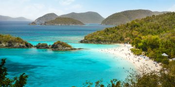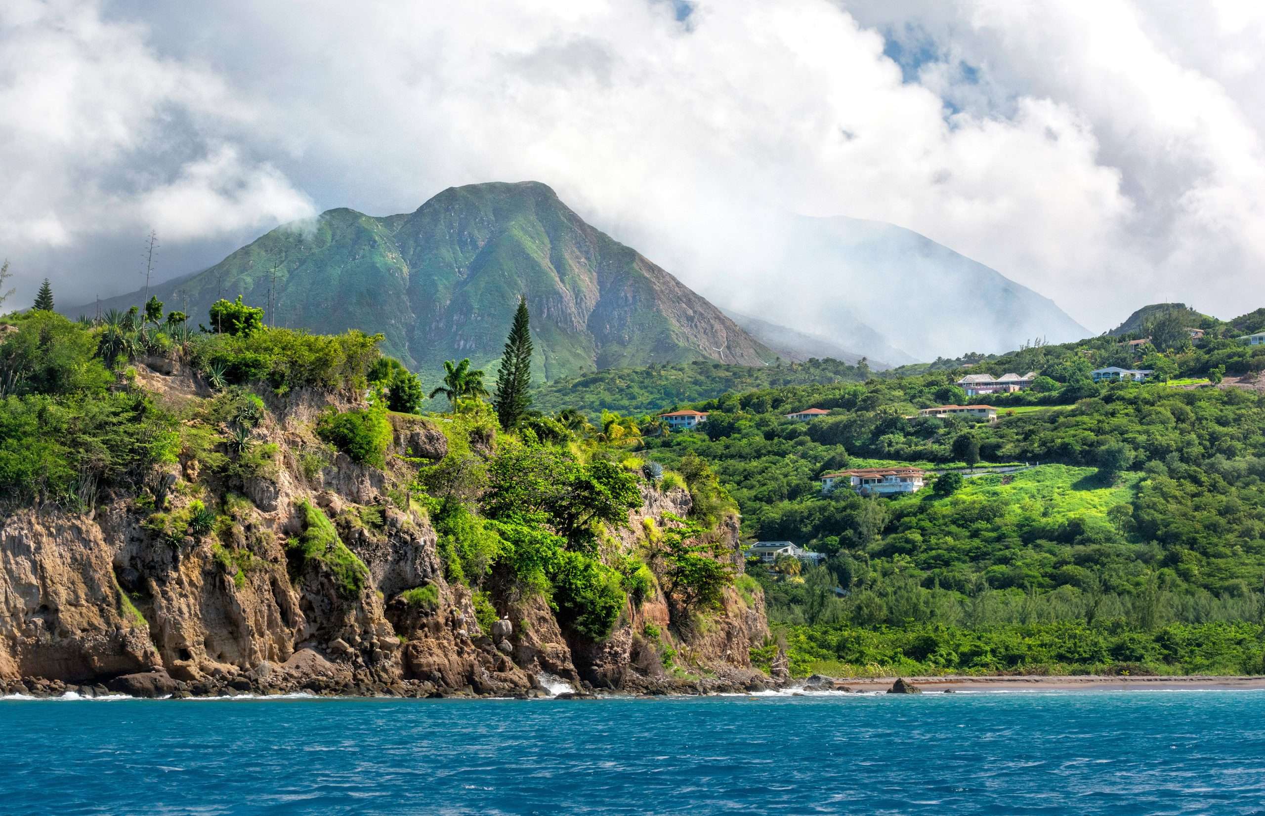

Volcanic forces have dramatically shaped the Caribbean’s islands over millions of years. Today, travelers can explore a diverse array of volcanoes—from underwater peaks rumbling beneath the waves to lush green mountain domes and even a “drive-in” crater. Below we highlight a dozen of the Caribbean’s most prominent volcanoes.
For each, we cover its location, type and notable eruptions, current activity status, fascinating facts, and how intrepid visitors can experience its natural wonders (safely!). Strap on your hiking boots (and maybe hold your nose at the sulfur vents) for an engaging island-hopping tour of Caribbean volcano adventures.
Volcanoes Highlighted:
- Soufrière Hills – Montserrat
- La Soufrière – St. Vincent
- Montagne Pelée – Martinique
- La Grande Soufrière – Guadeloupe
- Mount Scenery – Saba
- Mount Liamuiga – St. Kitts
- Nevis Peak – Nevis
- Sulphur Springs / Qualibou Caldera – St. Lucia
- Kick ’em Jenny – off Grenada (submarine)
- Boiling Lake – Dominica
- The Quill – St. Eustatius
- Digity Mud Volcano – Trinidad
- Hooiberg – Aruba
Soufrière Hills – Montserrat (British West Indies)
Half of the emerald-green island of Montserrat was turned into a modern-day Pompeii when the Soufrière Hills Volcano roared to life in 1995 after centuries of dormancy. This active stratovolcano – a complex of lava domes forming the island’s southern highlands – erupted continuously for years, burying the capital city of Plymouth under ash and pyroclastic flows. The eruptions (1995–2010) rendered about two-thirds of Montserrat uninhabitable and forced mass evacuations. Even today the volcano remains active, venting gas and heat, and an Exclusion Zone covers the south including Plymouth’s ghostly ruins.

Status & Facts: Soufrière Hills is active and closely monitored by the Montserrat Volcano Observatory. Its last major eruptive phase ended in 2010–2013, and while currently in a quieter state (Hazard Level 1), it still shows signs of unrest (seismic tremors, gas venting). The eruption raised the peak’s height from 915 m to about 1,050 m as new lava domes grew. Montserrat proudly markets itself as the “Pompeii of the Caribbean,” inviting visitors to witness an island reborn from volcanic destruction.
Visiting Tips: While you cannot hike to the summit (it’s far too dangerous), you can witness the volcano’s power from safe vantage points. Book a tour with a certified guide to enter the fringes of the Exclusion Zone on scheduled “volcano tours”. These take you to viewpoints overlooking Plymouth’s ash-buried buildings – a haunting sight of church steeples and rooftops poking from the gray ash, frozen in time. At the Montserrat Volcano Observatory visitor center, you can watch an excellent documentary on the 1995–97 eruptions and view the smoldering dome from a distance. Travel safety: Always follow government guidelines – parts of the island open or close depending on volcanic activity. Do not venture into restricted zones without permission. Even from safe areas, you’ll witness an awe-inspiring landscape of destruction and renewal, a testament to nature’s power.
La Soufrière – St. Vincent (Saint Vincent & the Grenadines)
The cloud-capped giant at the northern end of St. Vincent island, La Soufrière (“Sulphur Outlet”) is an active stratovolcano famed for both its beauty and its violent past. At 1,234 m, it is the highest peak in St. Vincent & the Grenadines and has erupted explosively multiple times in history. Notable eruptions include 1902, when La Soufrière erupted just hours before Martinique’s Mt. Pelée, killing 1,680 Vincentians and devastating Carib indigenous communities, and 1979, when an explosive eruption sent ash 160 km to Barbados but caused no fatalities thanks to timely evacuations. Most recently in April 2021, La Soufrière roared back to life after decades of dormancy – a new lava dome that had been slowly growing since late 2020 suddenly exploded in a series of powerful blasts.
The 2021 eruption blanketed St. Vincent in ash, displaced some 20,000 people, and dramatically altered the summit crater. Status & Type: La Soufrière remains active. It is a classic cone-shaped stratovolcano with a crater lake (during quiet periods) and a history of deadly Plinian eruptions. As of late 2025, the volcano is in a post-eruption cooling phase; the 2020–21 dome was largely blasted out, and monitoring is ongoing. Seismic activity has subsided since 2021, but scientists keep a close watch via the UWI Seismic Research Centre. The volcano’s very name “Soufrière” hints at the ever-present sulfur fumes. Indeed, the summit area often reeks of rotten eggs from volcanic gas. Geologically, it’s the youngest volcano on St. Vincent, with an age under 1 million years, and sits at the northern head of the Lesser Antilles volcanic arc.
Visiting & Safety: Hiking La Soufrière is an adventure for the fit and prepared. In quiet times, a trail from the windward (Atlantic) side leads through lush rainforest up to the crater rim at about 1,170 m. It’s a steep, 2–3 hour ascent that ends with jaw-dropping views down into the massive crater – a gaping chasm that may contain a warm lake or steaming vents depending on recent activity. Before attempting the hike, check the volcano’s status. Since the 2021 eruption, access has been subject to safety advisories; local guides are highly recommended to navigate any closures or hazards. When open, the trek reveals the volcano’s resilience: greenery is already returning to slopes scoured by ash. At the top, you might witness wisps of steam or smell sulfur. If you’re lucky and the weather is clear, you’ll have panoramic vistas of the island and even neighboring Grenadines. Always bring rain gear (the summit is often in clouds) and be prepared to turn back if conditions change. Travel tip: Many hikers start early morning to avoid afternoon cloud cover. For those less inclined to climb, the volcano’s grand profile can be admired from afar – for instance, from Richmond Beach or Georgetown, against the verdant backdrop of St. Vincent’s mountains. La Soufrière’s dramatic history and verdant, volcano-carved landscape make it a must-see (even if only from a safe distance) for adventure travelers in the southern Caribbean.

Montagne Pelée – Martinique (French West Indies)
Montagne Pelée towers above the town of Saint-Pierre in northern Martinique. This brooding active stratovolcano (“Pelée” means “peeled/bald” mountain in French) is infamous for the catastrophic eruption of 8 May 1902, the deadliest volcanic disaster of the 20th century. In that eruption, Pelée unleashed a superheated pyroclastic surge that obliterated Saint-Pierre – then the “Little Paris of the West Indies” – in minutes, killing nearly 30,000 people. The devastation was so complete that only two or three people survived in the entire city. Montagne Pelée continued erupting until 1905, then had a lesser eruptive episode in 1929–32 (when authorities wisely evacuated, avoiding casualties). After 1932, Pelée fell into an uneasy quietude. It last emitted lava in 1932 and since then has been dormant but not extinct. In fact, Pelée has been showing subtle signs of life again: increased seismic tremors from 2019 onwards prompted Martinique’s scientists to raise the alert level to Yellow in late 2020. The volcano remains under 24/7 watch by the observatory (OVSM-IPGP).
Status & Significance: Montagne Pelée is currently quiescent (no eruptive activity since 1932) but considered active – a giant under constant surveillance. Its 1,397 m summit is often cloaked in mist. The landscape around Pelée is stunning: the slopes transition from rainforest to fern-covered savanna near the top, and the summit area features dramatic craters and lava domes from past eruptions. In 2023, UNESCO recognized the extraordinary natural value of Pelée and Martinique’s northern volcanic peaks by designating them a World Heritage Site. This underscores not only the volcano’s geological importance but also the unique ecosystems (rich rainforests and rare species) that cloak its slopes. Culturally, Pelée’s 1902 eruption left an indelible mark: the ruins of old Saint-Pierre (like its theater and jail cell of the survivor Ludger Sylbaris) are preserved as monuments, and a small volcanology museum in Saint-Pierre recounts the tragedy.
Visiting & Activities: Montagne Pelée offers one of the Caribbean’s most iconic volcano hikes. A well-marked trail leads from the trailhead near Le Morne-Rouge up to the summit cones (several routes exist, such as Aileron trail). The trek is steep and can be muddy, but the reward is a panoramic view encompassing Martinique’s coastline and even Dominica to the north – if clouds permit. Along the way, you might pass gnarled trees and even feel the temperature drop as you enter cloud forest. At the top, you can peer into the oldest crater (the Étang Sec) which cradled the 1902 eruption, and see the newer lava dome (the 1929 spine). On clear days, the scenery is spectacular; on foggy days, the experience is mystically shrouded. Travel tips: Start early in the morning for the best chance of views before afternoon clouds. At the foot of the mountain, in the seaside town of Saint-Pierre, you can visit the Musée Vulcanologique, which showcases artifacts like melted bottles and church bells twisted by Pelée’s heat. Walking among Saint-Pierre’s ruins (the old theater, the ruins of the prison that saved Sylbaris) is a poignant step back in time. Thankfully, modern Saint-Pierre is a tranquil village of about 4,000 residents, rebuilt partly on the ashes of the old. When visiting Pelée, always heed any caution signs – if the volcano’s alert level rises, certain trails may close. Pelée’s mighty presence, tragic history, and lush natural surroundings make it a top highlight for nature lovers and history buffs in Martinique.
La Grande Soufrière – Guadeloupe (French West Indies)
Often called “La Soufrière de Guadeloupe” or simply “La Vieille Dame” (Old Lady), this is the highest peak in the Lesser Antilles at 1,467 m. Located on Basse-Terre island of Guadeloupe, La Grande Soufrière is an active stratovolcano with a complex of lava domes. Unlike Pelée’s cataclysmic reputation, Soufrière Guadeloupe is known for a dramatic non-eruption: in 1976, signs of an impending eruption (seismic swarms, gas emissions) prompted authorities to evacuate 72,000 people from the south of Basse-Terre. The volcano did erupt phreatically (steam explosions), covering the area in ash, but never produced the expected cataclysmic magma eruption – a controversial event in volcanology. No one was harmed (apart from a goat famously sacrificed by a farmer to “appease” the volcano), but the economy suffered. Earlier, Soufrière’s last magmatic eruption was around 1530 CE (long before records), so it’s been centuries since lava flowed. However, Soufrière remains very much alive: it constantly vents sulfurous gases, and has frequent earthquake swarms (e.g. a notable unrest episode in 2018).
Current Status: La Grande Soufrière is active (in a fumarolic stage). Visitors approaching the summit will notice strong sulfur odors and plumes of steam wafting from fumaroles near the top. The ground is warm and mineral-stained yellow and white from sulfur deposits. The summit area is a lava dome with no wide crater – instead it’s fissured and steaming. The last major activity was the 1976–77 series of steam eruptions and ongoing gas emissions; since then it has not had a magma outburst, but the volcano is continuously monitored by the Guadeloupe Volcano Observatory (OVSG). Soufrière sits in the heart of Guadeloupe National Park, a UNESCO Biosphere Reserve, surrounded by lush rainforest and waterfalls (like the nearby Carbet Falls). It’s both a natural treasure and a potential menace.
Hiking Experience: Climbing “La Soufrière” is one of the Caribbean’s most memorable volcano hikes. Trail & Access: A road leads up to the trailhead at Les Bains Jaunes (950 m), a thermal spring site where hikers often take a dip in warm volcanic waters before or after the hike. From there, the trail winds upward. The first section is a moderate walk through dense rainforest to the old parking area called Savane à Mulets (~1,140 m). As you emerge, you’ll notice vegetation shrinking – this zone was scorched by the 1976 steam blasts, creating an otherworldly landscape of low bush and bare rock fissured by volcanic forces. The final ascent is steep and rocky (rated “difficile”) as you scramble up lava boulders and muddy steps toward the summit. Rope handrails aid in some slippery spots.
Reaching the top, you find yourself on the rim of the active area with billowing vapors. Views can be phenomenal: glimpses of the Atlantic and Caribbean seas on either side of Guadeloupe, and even neighboring islands (Dominica to the south, Montserrat or Antigua faintly to the north) on a clear day. But often you’ll be in the clouds – part of Soufrière’s mystique.
At the summit, there are several fumarolic vents (one aptly named “Gueule Grand Gouffre” or big gaping mouth) and an overpowering sulfur smell. Many hikers don gas masks or cover faces with scarves when the fumes are strong. Safety notes: Stick to marked paths and viewing platforms. In the 1990s, a guide had an accident falling into a boiling mud pit when venturing onto a thin crust; since then, direct access to active vents is restricted. Today, you observe from a platform a short distance away. Do not enter closed areas – the ground can literally collapse into scalding mud. Despite the inherent risks, thousands safely hike La Soufrière each year. The round-trip is ~5–6 hours. Bring rain gear (showers are frequent), and start early to beat afternoon rain. If seismic activity spikes or the volcano is “agitated,” the park authorities will close the trail – always check current conditions. Post-hike tip: On your way back, stop by Bains Jaunes for a quick soak, or visit nearby waterfalls in the park. La Soufrière offers an unbeatable combination of adventure and natural beauty – a chance to walk on an active volcano and literally feel the Earth breathing beneath your feet.

Mount Scenery – Saba (Caribbean Netherlands)
On the tiny island of Saba (5 sq. mi. of sheer slopes), every road leads up the volcano – because the whole island is the volcano. Mount Scenery is Saba’s lofty dormant stratovolcano, rising to 870 m (2,854 ft) and crowned in cloud forest. It holds two notable titles: the highest point in the Kingdom of the Netherlands, and the northernmost potentially active volcano in the Caribbean volcanic arc. Geologically, Mount Scenery is a lava-dome complex atop an older volcanic cone.
Its last confirmed eruption was around 1640 AD, when explosions and pyroclastic flows were recorded in local legend. (Fortunately, the island was barely populated then.) No eruptions in the past few centuries, but scientists classify Saba as dormant, not extinct – an active volcano that’s just currently at rest. In fact, Saba has occasional earthquake swarms that remind residents of the sleeping giant below. For now, the volcano’s magma conduit is plugged by solid rock, which is why there’s no crater at the summit – instead the top is a dome covered in vegetation.
Nature & Significance: Mount Scenery is protected as a National Park (est. 2018) and offers a remarkable trek through multiple climate zones. Starting near sea level in the village of Windwardside, you ascend 1,064 stone steps hand-carved by locals decades ago. The trail begins in tropical foliage, passing old mango trees and farmland terraces from colonial days, then climbs into dense rainforest with tree ferns and wild orchids. As you near the summit, you enter a misty cloud forest draped in moss – often literally in the clouds. Keep an eye out for Saba’s endemic Red-bellied Racer snake or elusive mountain chickens (giant frogs). At the very top, when the mist parts, three viewing points offer stunning panoramas: you might see the outline of St. Eustatius, St. Kitts, Nevis, St. Barths, and Sint Maarten around you in the blue Caribbean expanse. On a clear day, the view is absolutely breathtaking – but clear days are rare on Mount Scenery’s aptly named peak!
Visiting: Hiking Mount Scenery is a must-do on Saba. It’s a steep but relatively short hike (about 90 minutes up for fit hikers, 2+ hours for others). Be prepared for a workout – those 1,000+ steps are no joke! The trail is well-maintained but can be slippery when wet (which is often). There’s a sign at the trailhead playfully issuing a “certificate” to those who conquer all the steps. Along the way, pause at the parapet viewpoint halfway up for a rest and scenery. Near the summit, you might find a guestbook in a mailbox to sign your name among the clouds. The highest point is marked by a small radio transmitter station. Safety tip: Wear sturdy shoes; the stone steps can have moss. And bring water – the tropical humidity will have you drenched in sweat. The weather can change fast; sunshine can turn to a downpour and fog in minutes. If thunderclouds threaten, better postpone (nobody wants to be on a mountain top in a lightning storm). Mount Scenery’s trail officially ends just shy of the true peak, but a short side scramble can take you to a volcanic vent area called “Mary’s Point” – a depression with steam vents and the faint smell of sulfur reminding you this mountain is only sleeping. After the hike, reward yourself with a taste of Saba’s famous rum or a dip in the sea. Mount Scenery, with its fairy-tale cloud forest and panoramic lookouts, is one of the Caribbean’s most enchanting volcanic hikes.
(Fun fact: As Saba has no beaches or large resorts, it markets itself with ecotourism – climbing Mount Scenery is the jewel experience. Saba is also known for world-class scuba diving on its submerged volcanic pinnacles.)
Mount Liamuiga – St. Kitts (Federation of St. Kitts & Nevis)
Rising above the sugarcane fields and forested ridges of Saint Kitts island is Mount Liamuiga, an imposing 1,156 m (3,793 ft) stratovolcano. This mountain – formerly known as Mount Misery – dominates the island’s northwestern skyline. Though now deeply verdant and tranquil, Liamuiga was once active; its last major eruption occurred approximately 1,600–1,800 years ago (around 160 CE). There are unconfirmed reports of activity in the 17th and 19th centuries (1692 and 1843) but no verified eruptions in recorded history. Today, Liamuiga is considered dormant. Its summit holds a spectacular 1-km wide crater, complete with a small seasonal lake and forest inside. The volcano’s slopes transition from old cultivated farmland at lower elevations to thick rainforests and cloudforest near the top. The name “Liamuiga” itself means “Fertile Land” in the Kalinago language – a fitting tribute to the rich volcanic soils that support lush vegetation. Indeed, as you hike, you’ll see giant trees, vines, and hear chattering green vervet monkeys which thrive on the mountain’s fruits.
Hiking the Volcano: Mount Liamuiga offers a challenging yet rewarding trek. Trail Overview: The adventure typically starts from the village of Newton Ground or Belmont Estate. A guided hike (highly recommended for first-timers) takes about 4–5 hours round-trip. The trail begins as a moderate uphill walk through farms and secondary forest, then gets progressively steeper and root-tangled as you enter the rainforest. Huge buttress-rooted trees tower above, and the air grows cooler.
The final approach to the crater rim is quite steep, requiring handholds on roots and rocks – you’ll be scrambling and using all-fours at times. At the top, you emerge onto the crater’s edge and catch your breath as you gaze down into the extinct crater. It’s an awe-inspiring sight: a deep, circular bowl carpeted in green vegetation. Depending on recent rainfall, you might see a small green lake at the bottom (it comes and goes over the years). Clouds often drift through the crater, adding to the mystique. On a clear day, the rim also affords panoramic views outward – the Caribbean Sea and neighboring islands of Saba, Statia, St. Barths, and St. Martin are sometimes visible.
Tips & Safety: The Mount Liamuiga hike is rated strenuous – it’s not a casual nature walk. You should be in decent shape and wear proper hiking shoes. The upper trail can be muddy and slippery (especially after rains, which are common in this tropical environment). Bring water and perhaps a snack to enjoy at the top while taking in the view. Many tour guides bring a rope to assist hikers with the final steep section and even offer the daring an option to descend partway into the crater. If you’re an adventure-seeker, you can carefully climb down a side trail a few dozen meters into the crater for an even more immersive experience – but this should only be done with a knowledgeable guide and in good weather. Wildlife: You’re almost certain to encounter monkeys scampering in the trees; these African green monkeys have made the forests their playground. You may also see the odd mongoose dash across the path.
After the hike, treat yourself to a refreshing dip at Black Rocks shoreline or a local beach – your legs will thank you. The entire experience, sweating up the “fertile land” and standing atop the highest peak of St. Kitts, is incredibly fulfilling. It gives a sense of the island’s geography – you can literally see how the island radiates from this volcanic center. Fun fact: When St. Kitts achieved independence in 1983, Mount Misery was symbolically renamed Mount Liamuiga (fertile land) to honor the island’s Carib heritage and optimistic future. Standing on its summit, surrounded by seas of tropical green, you’ll understand why the name is so apt.

Nevis Peak – Nevis (Federation of St. Kitts & Nevis)
Across the narrow channel from St. Kitts looms the island of Nevis, essentially a single volcanic cone rising from the sea. At its heart is Nevis Peak, a 985 m (3,232 ft) stratovolcano draped in greenery and usually wreathed in clouds. Nevis Peak is considered a potentially active volcano – there have been no confirmed eruptions in the past 10,000 years (last eruption date is unknown), but the volcano still has signs of life. Hot springs bubble on Nevis’ lower slopes (most famously at Bath Spring near Charlestown), and fumaroles vent gas near the summit crater, indicating magma not far below. The entire island is essentially the volcano’s edifice; during colonial times, people farmed the lower slopes but the upper mountain remained wild due to steepness. Thanks to that, Nevis Peak’s rainforest and cloud forest are largely intact, home to birds, orchids, and tree frogs.
Climbing Nevis Peak: Hiking this volcano is an adventurous, muddy, and steep undertaking – arguably even more challenging than Liamuiga. There is no easy stroll here; the trail (more of a route) goes nearly straight up in places, requiring ropes and hands-on scrambling over roots and rocks. It’s only about 3.5 km each way, but with ~900 m of vertical gain in that short distance! Most hikers take 2 hours up and 2 down, but it can vary. Guide strongly recommended: The path is not well-marked beyond a point, and visitors have gotten lost or stuck in bad weather. Local guides know the best route and have installed ropes at key points. The hike starts from about 300 m elevation in Gingerland or Clay Ghaut area. The first half is a gentle approach through farms and low forest. Then the trail hits the steep mountainside – here you’ll be clambering up natural ladders of roots. In the upper section, you might literally be climbing nearly vertical muddy slopes with the aid of fixed ropes and branches. It’s more of a climb than a hike. Expect to get dirty!
If you conquer Nevis Peak, the reward on a clear day is phenomenal – a 360° view taking in St. Kitts, Antigua, Montserrat, and all of Nevis island spread out below. However, Nevis Peak is rarely cloud-free. Often, hikers reach the summit only to be enveloped in mist. If lucky, the clouds part briefly to reveal blue sea and the island’s patchwork of villages and former plantation fields far below. Even without the view, the sense of accomplishment is huge. You’ll likely find a small Nevis flag or sign at the top to pose with as proof of your feat. Safety: Due to the difficult terrain, descending can be as tricky as ascending. Use caution, take your time on the ropes, and three-point contact on those slippery rocks. After rains, avoid this hike as it becomes very treacherous. Also, afternoon showers crop up suddenly – morning is the best time to go.
It’s often said that only the brave (or crazy) hike Nevis Peak, and locals joke that enjoying the view of the volcano from the beach might be preferable. In fact, many visitors opt to admire Nevis Peak from the comfort of Pinney’s Beach, perhaps with a famous Killer Bee rum punch from Sunshine’s Bar in hand. This is a perfectly fine way to appreciate the volcano – Nevis Peak’s near-symmetrical cone, often with a “cloud cap,” is the defining postcard image of the island. For those who do tackle the summit, you earn serious bragging rights! Just make sure you wash off the mud and reward yourself with a dip in the hot spring or the sea afterwards. Nevis Peak stands as a beacon of adventure on this tranquil isle – whether you climb it or simply gaze up at its mysterious cloud-shrouded crown.
Sulphur Springs (Qualibou Caldera) – St. Lucia
In St. Lucia, the very ground seems alive in the town aptly named Soufrière. Here, instead of a classic mountain, you find the Sulphur Springs – a steaming geothermal field inside the collapsed Qualibou volcano, which St. Lucians proudly call “the world’s only drive-in volcano”. Indeed, a road leads right into the crater! St. Lucia’s major volcanic complex is the Soufrière Volcanic Centre, a large caldera formed ~32–39,000 years ago. While the towering twin Pitons (Gros Piton and Petit Piton) nearby are the picturesque remnants of past volcanic domes, the active part of the system lies at Sulphur Springs. Here, boiling mud pools, hissing fumaroles, and sulfur-stained rocks create a surreal, lunar landscape[66]. The last minor eruption was a steam explosion in 1766 – relatively tame, but it shows the volcano is only dormant. Today, heat from magma just a few kilometers below fuels bubbling pools at near 100°C, sending up plumes of rotten-egg-smelling steam[66].
Visiting the Springs: The Sulphur Springs Park is St. Lucia’s most popular natural attraction, drawing about 200,000 visitors a year. You literally drive to the edge of the active area, park, and join a guided walking tour along safe boardwalks. You’ll see (and smell!) up close the burbling gray mud, thermal water venting from cracks, and multicolored mineral deposits (yellows, oranges, and whites from sulfur, iron, and calcium)[66]. Guides will point out features like the “Devil’s Gate” and the spot where a guide named Gabriel fell in up to his waist when a thin crust gave way in the 1990s – now called “Gabriel’s Hole”. (He survived with burns; since then, walking on the soft crust is forbidden and viewing is from a platform a safe distance away.) The heat underfoot is palpable; some areas could probably boil an egg. You might notice no vegetation grows in the most active spots, though just a few yards away tropical bushes thrive – a stark contrast.
Fun & Relaxation: Just downstream of the springs, the hot mineral-rich waters mix with cooler streams, creating pools perfect for a volcanic mud bath. Tourists love this! You can slather yourself in warm sulfurous mud, which is believed to have therapeutic properties for the skin, then rinse in the hot springs (around 45°C). It’s like a natural spa experience amid the rainforest – you’ll emerge tinged gray but supposedly “10 years younger”! Whether or not the fountain of youth is real, it’s undeniably fun to cover each other in mud and pose for pictures looking like swamp creatures. After the mud dries, you wash off under warm waterfalls. Many visitors swear their skin feels smoother.
Safety and Tips: The Sulphur Springs are well-managed; just obey the guides, stay on marked paths, and you’ll be fine. The sulfur smell is strong – some find it overwhelming, but you get somewhat used to it (tip: breathing through your mouth a bit can help). Old folklore says birds and small animals avoid the area due to the fumes, lending it an eerie quiet. The experience is suitable for all ages (kids usually find the bubbling pools fascinating). Bring an old swimsuit if you plan the mud bath, as the sulfur can stain fabric. Also, remove silver jewelry – the sulfur will tarnish it black (sulfur reacts with silver). Beyond the Springs: While in Soufrière, you’re in one of the most beautiful parts of St. Lucia. The iconic Pitons rise just to the south; consider a hike up Gros Piton or at least a boat ride to see them. Waterfalls like Toraille and Diamond Falls (the latter also geothermally heated and colorful from minerals) are nearby, as are lush botanical gardens. Many visitors pair a morning volcano visit with an afternoon snorkeling or beach time – truly enjoying all “fire and water” that St. Lucia offers.
Sulphur Springs may not be a towering peak, but it’s an unforgettable encounter with the Earth’s inner chemistry. It’s easy to visit – drive right in and feel the heat of a dormant volcano beneath your feet. Just hold your nose and enjoy this marvel of nature up close!
Kick ’em Jenny – off Grenada (Underwater Volcano)
About 8 km (5 miles) north of Grenada, beneath the turquoise Caribbean Sea, lies a hidden but highly active volcano named Kick ’em Jenny. This submarine volcano is the only known “live” underwater volcano in the Eastern Caribbean. Although its peak is currently 180–200 m below sea level, Kick ’em Jenny has erupted at least a dozen times since discovery in 1939, when an explosive eruption sent a dome of water 300 feet high and was heard in Grenada. The volcano’s quirky name comes from local sailors; one theory is that turbulent waters above the vent “kick” boats around, like a feisty mule named Jenny. Another theory ties the name to a nearby islet. Regardless, it’s a fitting moniker for a volcano that refuses to stay quiet.
Activity & Hazards: Kick ’em Jenny is very much active – it tends to erupt on average every few decades. Notable eruptions occurred in 1939, 1948, 1953, 1965, and as recently as July 2015. Most eruptions are moderate (VEI 1–3), producing gas and ash that usually don’t reach the surface dramatically. However, they pose two main hazards: tsunamis and gas-rich water. A violent eruption could displace enough water to generate small tsunamis affecting nearby coastlines (none have been significant in recorded events). Also, large emissions of volcanic gases can lower water density, potentially causing ships to lose buoyancy (which is why mariners must steer clear). For safety, an exclusion zone around the volcano is enforced: boats are advised to keep 1.5 km away normally, expanded to 5 km during eruptive episodes. Fortunately, Kick ’em Jenny is closely monitored by the UWI Seismic Research Centre, and Grenadian authorities issue alerts if it rumbles.
Can you visit it? Not directly – you can’t exactly snorkel a erupting volcano! The summit is deep underwater; no part breaks the surface (yet). However, adventurous scuba divers at certain sites around Ronde Island and the Grenadines have reported feeling tremors or hearing rumbling sounds during Kick ’em Jenny’s activity. Imagine hearing the “boom” of an undersea eruption while underwater – a thrilling (and humbling) experience as described by some divers. Unless you are part of a scientific expedition with a submarine, viewing Kick ’em Jenny itself is not possible. There have been research missions mapping its crater – interestingly, it has an inner crater ~krater and has grown a cone that is inching upward with each eruption. One day, centuries hence, if eruptions continue, Kick ’em Jenny might even emerge as a new island.
For travelers, the significance of Kick ’em Jenny is knowing it’s there – a reminder that the Lesser Antilles arc is geologically alive from the seabed up. If you visit Grenada’s northern town of Sauteurs or boat around the Grenadine island of Carriacou, you’re in Jenny’s neighborhood. Some tour operators and museums in Grenada provide information on it. Unique fact: This submarine volcano is part of the reason the Grenadines have such rich marine life; volcanic nutrients feed plankton which feed fish. So indirectly, divers and snorkelers can thank Kick ’em Jenny for the vibrant reefs nearby.
While you can’t stand on Kick ’em Jenny (yet), just knowing a volcano is bubbling away under the sea surface as you sail by is awe-inspiring. It’s one of the Caribbean’s intriguing natural phenomena – unseen but not unfelt. If you’re sailing in the area, respect the exclusion zone markers on nautical charts. Otherwise, enjoy Grenada’s above-ground volcanic features (like Grand Etang crater lake) and perhaps regale fellow travelers with the tale of the undersea volcano beneath your keel!
Boiling Lake – Dominica (Morne Trois Pitons National Park)
A cauldron in the jungle: Dominica’s Boiling Lake simmers an eerie blue-green, shrouded in vapor. This is not a volcano’s peak but rather a volcanic wonder: the Boiling Lake, high in the mountains of Dominica, is the world’s second-largest hot lake. It’s essentially a flooded fumarole – a vent in the Earth’s crust where volcanic gases heat groundwater to boiling. The lake is about 60–75 m across, constantly bubbling at ~90°C around the edges (and likely at true boiling 100+°C at the center). Set at ~800 m elevation in Morne Trois Pitons National Park (a UNESCO World Heritage Site), the Boiling Lake is a dramatic reminder of Dominica’s geothermal vigor. Dominica, “The Nature Island,” actually has nine active volcanoes (the most of any Caribbean island) – though none have erupted magmatically in recorded history, the island is rife with hot springs, sulfur vents, and even a tiny lava dome eruption in the 1990s underwater. Boiling Lake itself has “erupted” in a sense: in 1880 a steam explosion in the nearby Valley of Desolation caused the lake to drain suddenly, only to refill days later. It also partially drained during a 2004 volcanic gas fluctuation and then refilled in one dramatic surge. These fluctuations show that the lake is perched above the water table, fed by rain and heated by volcanic gases rising from below.
The Hike: Reaching Boiling Lake is half the adventure. It’s a legendary trek, often cited as one of the Caribbean’s most challenging and rewarding hikes. The journey is ~13 km round-trip (8+ miles) from the village of Laudat and takes 6–8 hours of serious hiking through the wilderness. The trail begins in dense rainforest, climbs over a mountain (Morne Nicholls ~3,168 ft), then descends into the otherworldly Valley of Desolation – a ravine of sulfur vents, hot streams, and mineral-stained rocks. The Valley of Desolation truly feels like another planet; the ground steams and every step must be chosen carefully to avoid scalding. (Tiny sprays of steam can easily burn unwary ankles!) In this valley, you hop over bubbling rivulets and perhaps boil an egg in a hot spring (guides often do this!). Finally, you’ll scramble up a last ridge and suddenly, the vista of Boiling Lake emerges through the mist. It’s a surreal sight: a churning oval lake of gray-blue water, enveloped in swirling clouds of steam, with a strong smell of sulfur in the air. The lake’s surface often has a rolling boil in the middle, sending ripples to the edge where scalding water spills over into a stream. You view it from a rocky ledge about 30 m above the lake shore – do not try to go down to the water (for obvious reasons!). The surrounding cliffs are slick and steep.
Experience & Tips: Standing at Boiling Lake is like peering into the Earth’s bubbling soup pot. The combination of the roar of the boiling water, the hiss of steam, and the stark, wet, grey-rock environment is unforgettable. Most hikers picnic at a safe distance, enjoying the heat radiating up (it can feel like a sauna after the chilly mountain rain). Safety: Go with a guide or experienced group – the trail is unmarked in places, and the Valley of Desolation can be dangerous if you stray (people have been injured by falling into boiling pools or inhaling noxious gas). Wear sturdy boots that you don’t mind getting muddy. The hike features very steep sections, so a walking stick helps. Start early (guides often set out by 7–8 AM) to avoid getting trapped by nightfall on return. Weather is fickle; rain can make trails into mudslides, so try for a dry day. Carry plenty of water (ironic as that sounds visiting a giant boiling vat!). Test your footing around any hot areas – ground can be thin. Despite these cautions, hundreds of adventurers safely do this hike every year with proper preparation.
Dominica doesn’t have the flashy explosive volcano history of some islands, but Boiling Lake encapsulates the raw power rumbling just below the surface. After conquering the hike, reward yourself with a soak in Dominica’s many cooler hot springs (like Wotten Waven) to soothe sore muscles. When you tell the tale of hiking to a boiling lake in the jungle, it tends to raise eyebrows – it’s a travel achievement that sets you apart! This is nature’s adventure at its finest: strenuous, slightly perilous, but absolutely magnificent.
(Note: In recent years, Boiling Lake’s level has occasionally dropped due to vent blockages – the lake can temporarily “drain” exposing a muddy hole with steam vents. If you arrive during such a phase, it’s still fascinating, though maybe less photogenic. It always refills eventually once the subterranean plumbing clears, so future visitors can see it at full boil again.)
The Quill – St. Eustatius (Caribbean Netherlands)
On the small Dutch island of St. Eustatius (Statia) lies an eye-catching volcano with a perfectly circular crater – so perfect the Dutch named it “De Kuil” (The Pit), which became The Quill. The Quill is a dormant stratovolcano rising to 601 m (1,972 ft) on Statia’s southeastern side. Its last eruption is estimated to have been around the 3rd to 5th century AD, based on geologic evidence (no historical records exist). Thus, it’s considered dormant; no signs of activity in recent times, though shallow seismic events occasionally occur. The Quill’s symmetry and accessible crater make it a unique volcano to explore. The slopes are blanketed in dry forest at lower levels, transitioning to evergreen rainforest in the crater and upper rim. The inside of the crater is like a secret garden – a forest with huge silk cotton trees and wild orchids, protected by the encircling crater walls. In fact, The Quill’s crater forest is a designated national park and was one of the first UNESCO sites in the region for its biodiversity.
Hiking into a Crater: Statia offers the rare opportunity to hike not only up a volcano, but down inside its crater. A well-maintained trail begins near the Quill’s base (just outside the capital Oranjestad) and zig-zags up the outer slope. Along the way, you’ll likely encounter lizards and hear chirping birds – Statia’s nature is quite pristine. After about an hour of moderate uphill, you’ll reach the crater rim at about 370 m elevation. Here, a signposted viewpoint allows you to peer into the depths of the crater – a moment that often elicits a “wow.” It’s an emerald bowl beneath you, with the tops of tall trees nearly level with you and dense foliage carpeting the crater floor some 230 m below. If you’re up for more adventure, a steep trail leads down into the crater itself. This path requires clambering over rocks and using roots as handholds (there are ropes at tricky spots). Within 20–30 minutes, you descend to the crater floor. Instantly, you are in a different world: the air is cooler and still, giant tree trunks surround you, and the crater walls rise like a green amphitheater around. It’s common to see wild hermit crabs scuttling about (they climb up here from the sea!). The sense of tranquility is magical. One particular giant kapok tree in the crater is famous – its buttress roots form surreal shapes. There is even a small geocache box hidden down there for treasure hunt enthusiasts.
Views & Points of Interest: After exploring the crater, climb back out and consider circling part of the rim. There are spur trails to the Quill’s highest points, from which – on a clear day – you can see the islands of St. Kitts, Nevis, and St. Barths, and even the outline of Saba’s volcano in the distance. The Quill’s rim also offers views of Statia’s northern hills (which are actually an older, extinct volcanic complex) and the town below. Wildlife: The Quill is home to the Antillean iguana (critically endangered; if you’re lucky you might spot one sunning) and many birds like doves, tremblers, and hummingbirds.
Practical tips: The hike up the Quill is considered medium difficulty – about 1 hour up to rim, plus extra for crater descent and exploration. Go in the morning to avoid midday heat (the lower trail is exposed until you hit shade higher up). Wear good shoes; trails can be rocky. Bring water – the tropical sun can be intense. There are no entrance fees; the park is managed by STENAPA, the local conservation agency, and donations are welcomed. Guides are available but not required as trails are clearly marked. One should, however, not attempt the inner crater if it has rained heavily – it can be slippery. Also, watch out for sudden gusts on the rim.
The Quill offers a relatively off-the-beaten-path volcano experience – Statia is quiet and sees few tourists, so you might have the entire volcano to yourself! Standing in the silent crater or atop the rim with sweeping Caribbean views, one can’t help but feel a deep connection to nature’s grand design. Bonus: After the hike, you can snorkel over Statia’s underwater archaeological park or visit restored colonial era ruins – Statia is rich in history too. But it’s the volcano that truly symbolizes this island’s character. The Quill is even depicted on Statia’s flag and coat of arms. For any volcano enthusiast, adding “hiked into The Quill’s crater” to your list is a highlight.
Trinidad’s Mud Volcanoes – Digity, Trinidad (Southern Caribbean)
Not all volcanoes tower into the sky – in Trinidad, some burp and bubble quietly in the form of mud volcanoes. These aren’t magma-spewing mountains but rather mounds of wet mud and clay caused by underground gas pushing up soft sediments. Trinidad’s most famous is the Digity Mud Volcano, located in the island’s deep south near Penal. It’s a modest cone about 6–7 m (20 ft) high, oozing cool gray mud and frequently belching methane gas with a gentle blub-blub sound. Visiting Digity (and other mud volcanoes in Trinidad) is a quirky, fun excursion for nature lovers. The area looks like a mini badlands – a cracked mud dome with a small caldera-like pit at the top filled with viscous mud. Every so often, the mud boils and spurts as gas escapes, sometimes even causing the mud to overflow and slowly enlarge the cone.
Why they occur: Trinidad’s mud volcanoes are tied to its petroleum-rich geology. Pockets of pressurized natural gas (often methane) deep underground force their way up, mixing with water and clay on the way. The result: a gurgling mud volcano at the surface, often far from any volcanic arc (Trinidad isn’t on the active arc – it’s on the South American plate). So, these are not “true” magmatic volcanoes, but they certainly look like little volcanoes, complete with craters and mud lava flows! There are over 20 mud volcano vents in Trinidad, some on land and some even offshore (one famously erupted in the ocean in 2018). They’ve been active for millennia; indigenous peoples likely noticed their “earth farts,” and some cultural lore developed that the mud has healing or spiritual properties.
Visiting Digity: A short walk from the road leads you to Digity’s cone. It’s often dry-ish around the base, with a well-worn path from curious visitors climbing up to peek in the mud pit. You might see bubbles forming and hear hissing as gas escapes. There’s usually a sulfur or petroleum smell (faint). It’s tempting to poke a stick in or touch the mud – go ahead, it’s cool to the touch. Local legend even claims the mud makes a great revitalizing facial mask, so don’t be surprised if you see Trinidadians smearing some on their skin for a DIY spa treatment! (Whether it’s effective is debatable, but it makes for great photos.) Fun tip: If you press your ear to the ground on the cone (carefully), you might hear the gurgling inside.
Trinidad’s mud volcanoes occasionally have larger eruptions – not with fire, but with lots of mud. In 1997, one mud volcano suddenly spewed thousands of cubic meters of mud, flooding a nearby village (known as the Piparo mud volcano eruption). Digity is relatively tame, however. It continuously oozes rather than explosive. Safety: Treat the mud volcano respectfully; the mud can be deep near the vent – you don’t want to fall in and get stuck. It’s like quicksand consistency. Also, wear old shoes – the area is obviously muddy. After rains, the approach can be very slick.
Other sites: If Digity sparks your interest, Trinidad has several accessible mud volcanoes. The Devil’s Woodyard is a park area with a few low mud cones that occasionally erupt; its name comes from an 1852 eruption that shook the ground so hard it felled trees (hence a yard fit for the devil). On Trinidad’s east coast, near Mayaro, there’s a famous mud volcano that created a temporary island offshore in 2018. And in the swampy Nariva area, the mud volcanoes sometimes catch fire (when gas ignites) – a phenomenon called “Burning Mud”.
Visiting a mud volcano is a reminder that not all of Earth’s strange exhalations take the shape we expect. It’s messy, it’s weird, and it’s fascinating – and makes for a rather unique travel story. Plus, who can resist the chance to literally play in the mud? So if you’re in Trinidad, consider a detour to Digity or Devil’s Woodyard for some down-and-dirty volcanic fun. Just don’t forget a towel and a sense of humor!
Hooiberg – Aruba (Southern Caribbean)
Aruba, renowned for its white sandy beaches and arid landscapes, seems an unlikely place to talk about volcanoes – it lies outside the active volcanic zone, and no eruptions have occurred there in human times. However, smack in the middle of this flat island rises a lone hill called Hooiberg, which is actually the solidified core of an ancient volcano. Hooiberg (Dutch for “Haystack”) is a 165 m (541 ft) high cone that indeed looks like a haystack from afar. It’s covered in cacti and divi-divi trees rather than lush rainforest, but it’s an iconic landmark visible from almost anywhere on Aruba. Geologically, Hooiberg is composed of quartz diorite (an igneous rock), part of Aruba’s volcanic origin roughly 85 million years ago. While it’s completely extinct now, it’s significant enough to have a place on Aruba’s coat of arms (that’s right – the island so identified with beaches put its lone “volcano” on its official emblem).
A Leisurely Climb: Hooiberg is a favorite spot for both locals and tourists to get some exercise and panoramic views. The government built a staircase of over 600 concrete steps to the summit. Climbing these steps is a mini-workout, especially under Aruba’s strong sun, but it’s doable in 20 minutes or so (bring water!). Along the way, you might spot some Aruba whiptail lizards darting about or burrowing owls (Aruba’s adorable national bird) in the scrub. As you ascend, the vistas broaden – the island’s patchy green cunucu (countryside) and gold-colored rock stretches out below, with hotel high-rises dotting the shoreline in the distance.
At the top of Hooiberg, you’ll find antennas and telecom equipment (not the most romantic, but necessary for the island). There’s a small lookout area where you can enjoy a 360-degree view of Aruba. On a clear day, you can even see Venezuela’s coastline to the south. To the west is Oranjestad, the capital, and the sparkling Caribbean Sea beyond. To the north and east, you’ll see the rugged Arikok National Park hills and more cacti plains. Sunrise and sunset from Hooiberg are particularly beautiful times to be up there – the sky’s colors are enhanced by the broad vista.
Accessibility: Getting to Hooiberg is easy – it’s centrally located, and a short drive from Oranjestad or the hotel areas. There’s parking at the base off the Santa Cruz area. The climb itself, as mentioned, is via a staircase so no hiking boots needed (sneakers are fine). Just watch your step as some sections can be uneven. There are a couple of benches along the way if you need a breather. Try to avoid midday heat; early morning or late afternoon is preferable (plus the lighting is nicer for photos). There’s no entry fee; it’s an open public site.
While Hooiberg won’t wow anyone with volcanic drama (no craters or fumaroles here), it provides a poignant sense of Aruba’s geologic past and present flatness. It’s literally a high point of the island – quite literally one of the only high points! Kids and families often do this outing for a break from beaches. It’s said that in the early 19th century, a few gold mining attempts occurred around Hooiberg’s foothills, but now it’s just a peaceful lookout. Fun legend: Some Arubans say Hooiberg is home to hidden gold or treasure, but none has ever been found.
In an island known for relaxation, the short but steep trek up Hooiberg is a nice change of pace and perspective. And once you’ve stood atop Aruba’s “volcano,” you can reward yourself with a cold Balashi beer or a dip in the sea, knowing you conquered the Haystack. It may be the smallest “volcano” on our list, but Hooiberg has big pride in Aruba’s culture and offers big views for those who ascend it.
Final Travel Tips & Safety: Volcanoes are dynamic features, so always check the latest local advice before exploring them. Some active volcanoes (like Montserrat’s or St. Vincent’s) may have off-limits areas that change with activity levels. If a guide is recommended (e.g., Nevis Peak, La Soufrière, Boiling Lake), invest in one – it supports the local economy and keeps you safer. Pack essentials: sturdy footwear, rain jacket, sun protection, plenty of water, and perhaps a small first aid kit for scrapes. Respect the power of nature – even seemingly dormant sites can have hidden dangers (sudden weather, treacherous terrain, or in the case of Sulphur Springs, scalding water).
That said, don’t be afraid to explore! The Caribbean’s volcanoes offer some of the most enriching travel experiences – where else can you hike through a rainforest to a boiling lake, snorkel over a seamount, or drive into a steaming crater? From the tales of eruptive fury to the serene beauty they now bestow, these volcanoes are integral to the Caribbean’s character. As you enjoy a panoramic vista from a summit or relax in a volcanic hot spring, you’ll gain a deeper appreciation for the powerful forces that shape our world – and create such spectacular places for adventure. Happy (and safe) volcano trekking!
Sources: Connected references have been used to ensure accurate and up-to-date information on volcano history, status, and travel details, including the Montserrat “Pompeii of the Caribbean” narrative, the recent eruption details of La Soufrière St. Vincent, hiking insights from Caribbean travel experts, and scientific facts from the UWI Seismic Research Centre and Global Volcanism Program. Each volcano’s section above cites specific sources for verification and further reading. Enjoy your exploration of these fiery Caribbean gems!