
Story and photos by Lexi Fisher and Chris Doyle
As a sailing guide writer, one of the most frequent questions I get asked is “whatisland is your favorite?” which is incredibly subjective, of course, and a bit likeasking someone to choose their favorite child. Each island has something uniqueto offer: dining options, great snorkeling and diving, safe and convenientanchorages, availability of technical services, and so forth. But inevitably, theconversation turns to Saba. Despite its lack of reliable or protected anchorages, it stands out as a destination for those who want to get off the beaten track andexperience something truly special.
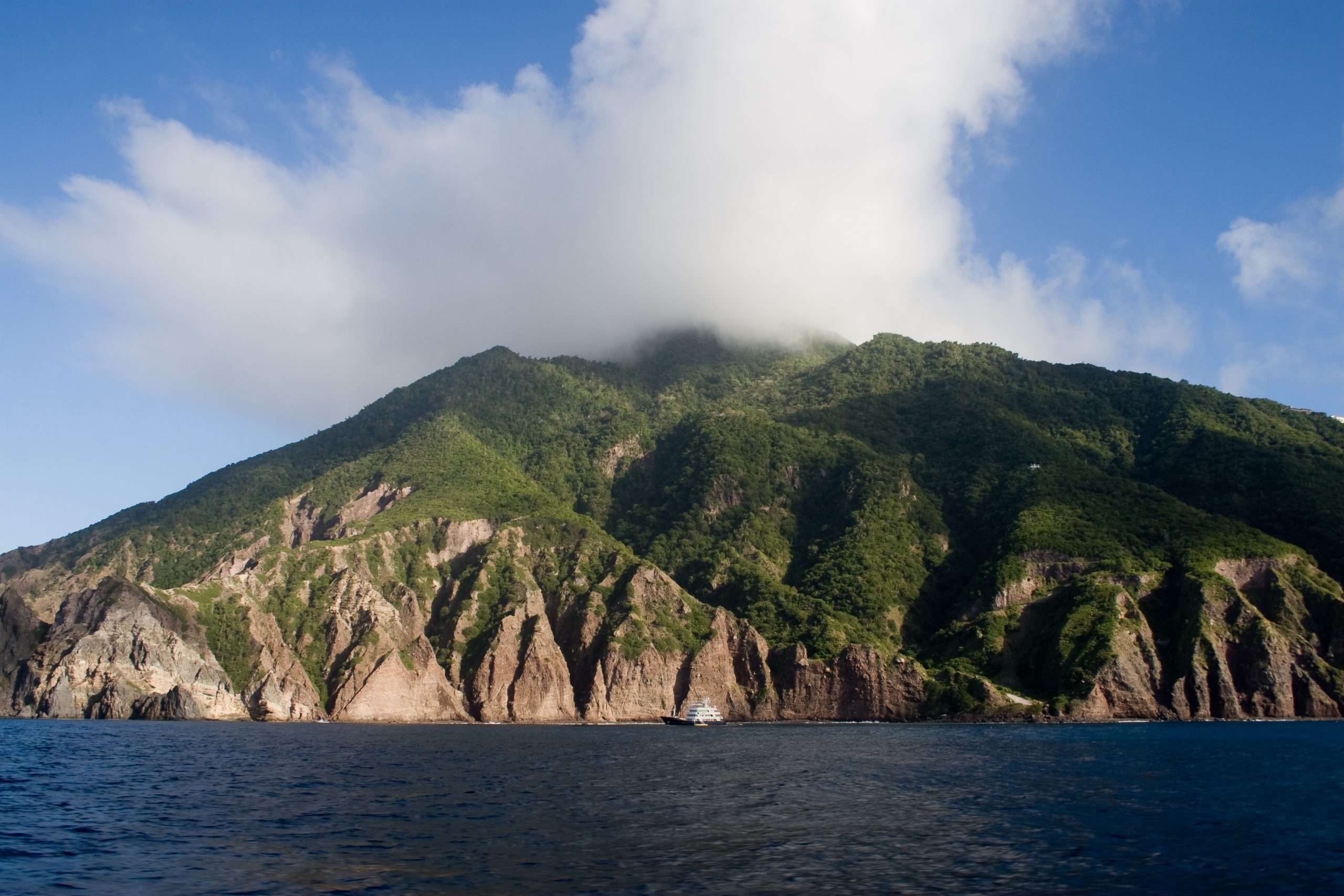
Saba rises from the sea like a fairy tale picture of a forbidden land. A mere five square miles, it reaches a lofty 3,084 feet. Tall cliffs of red, pink, and brown risealmost vertically from the sea. Houses sit perched in seemingly impossiblepositions on the edges of precipices. Ashore, it lives up to its image, for, if therewas ever a hidden Shangri-la in the Caribbean, it is Saba.
Until the early 1940s Saba was almost inaccessible. Everything had to come and go via Ladder Bay. This extraordinary landing on the leeward shore provides scant shelter from ocean swells. Some 800 steps are cut into the rock. The steepness of the steps and their elevation can be appreciated from the sea by looking at the old customs house, which is only halfway up. Boats could only land when the sea was calm and even then, men had to stand waist deep in water to handle the cargo. Everything from the outside had to be carried up, including, at different times, a piano and a bishop. The Sabans were prepared to prevent invasions by keeping piles of boulders stacked behind wooden supports that were cut down when attackers were halfway up the hill. A road was built to Fort Bay in 1943, but with no port to shelter the bay, the island was still impossible to reach much of the time.

The windward side of Mount Scenery


A hike on Mount Scenery
The roughly 1,500 inhabitants are descendants of hardy Dutch, Scottish, and English settlers, along with a few Africans who originally came as enslaved people. They have worked hard, side by side, to derive a decent living from this rugged land. They became great seafarers, fishermen, farmers, cobblers, and boat builders. In more recent times, women have become skilled in lacework. Sabans take great pride in their work and are unimpressed by obstacles. The two main villages in Saba are named The Bottom and Windwardside.
Up until the 1950s, the only way to get between the villages was to walk along a steep mountain track. Engineers came from The Netherlands and said the steep terrain precluded the possibility of a road. So Joseph Hassel, born in 1906, took a correspondence course in road building and the Saban people hand-built their road. It took them several years and it was finished in 1958. Dutch engineers similarly disparaged the idea of an airport. The Sabans called in Remy de Haenen, a pilot from St. Barts. He looked over their one flat-topped rock and figured landing might be possible. The Sabans flattened the area as much as they could by hand, removing big rocks and filling in holes. Remy landed, proving the feasibility of flying in.
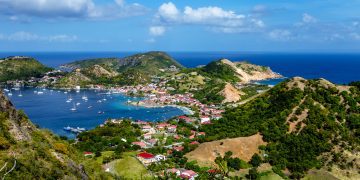
Today Sabans have their airport, a road to the sea, and a tiny harbor. Despite its lack of beaches, Saba attracts visitors. Some come to go diving, rated among the Caribbean’s best. Others come for a glimpse of this remote island, which developed in isolation, away from the mainstream of Caribbean life. The first surprise is the beauty of the island. From the sea it looks like a rock, but up high in the hills the views are spectacular. The island is spotlessly clean, with villages of whitewashed, green-trimmed, red-roofed cottages that look like they were plucked from Europe sometime in the 19th century. There are cobblestone streets, low stonewalls, and small stone churches. The people are honest, straightforward, industrious, and cheerful. They have a strong sense of community and there is very little crime.
Saba is special. If you visit, you will never forget it. It is a nature island with many really lovely hikes, all generally well maintained. Some years ago Saba became part of the Netherlands. From a cruising perspective the result has been the creation of a whole new bunch of bureaucracy.
Industries include a small amount of tourism, the mining of gravel and sand from one of the hillsides near Fort Bay, and an international medical school whose students, when in residence, add about 30-50 percent to the population. This, plus the arrival of a few more visitors and the building of a few more hotels, has brought some changes: There are more shops and their stock is much more plentiful; restaurants are excellent and booming. There are even a couple of discos.
Saba is not the easiest of anchorages, though the addition of yacht moorings and a good dinghy dock in the port make it much easier than in days of old. A few bareboat charter companies make it off-limits for their guests. Those not allowed to visit by boat should consider going by airplane or ferry. The least expensive way is a ferry from St. Maarten, Statia, or St. Kitts. The Edge ferry from the Police dock next to the Simpson Bay Bridge, Sint Maarten, usually runs on Tuesdays and Fridays, but the schedule changes. If you want to stay a few days or are coming from Statia or St. Kitts, the Makana ferry runs from Bobby’s Marina in Philipsburg, Sint Maarten, every day but Monday and Tuesday, from Statia every day but Wednesday and Friday, and from St. Kitts on Monday and Friday. You can book online at makanaferryservice.com. If you prefer to fly, check the WinAir schedule online.
If you have good weather and sea conditions and do decide to sail there, be aware that the island’s parks authority, which maintains and controls the anchorages and moorings, is currently working with the Dutch government (and have been for the last eight months or so) on a new fee system, which may or may not be in effect by the time you get there.
Doyle Guides contain the Eastern Caribbean’s most comprehensive and reliable sailing information, available in hard copy and online through a free mobile app, website, and Facebook group. (www.doyleguides.com).

Saba Entry and Exit Procedures from Noonsite.com
Ports of Entry:
Fort Bay (Fort Baai) Harbor is Saba’s only port of entry.
Advance Paperwork:
While Saba uses SailClear, they do require additional forms that can be downloaded, printed and filled out prior to visiting the harbor offices to streamline check-in. See Noonsite’s Clearance page for full details. For many countries, a visa is not required.
Entry Process:
All crew should proceed to the harbor office building to clear-in with customs and immigration and finally the harbor master. If C&I are not available, then the HM deals with all formalities. Yachts must also clear in with the marine park office nearby.
Exit Process:
The exit process is the same as the entry process. It’s usually possible to clear in and out at the same time, even if you are staying a few days.
Rates:
Harbour fees are US$20-$40 depending on tonnage. There is a US$10 per person departure tax and nightly fees for the marine park. See a breakdown of fees on Noonsite.
This information is provided by Noonsite.com, specialists in worldwide formalities for yachts, and was accurate at press time. Check here for more information and updates.

A map of the island